Geolocation
What is geolocation?
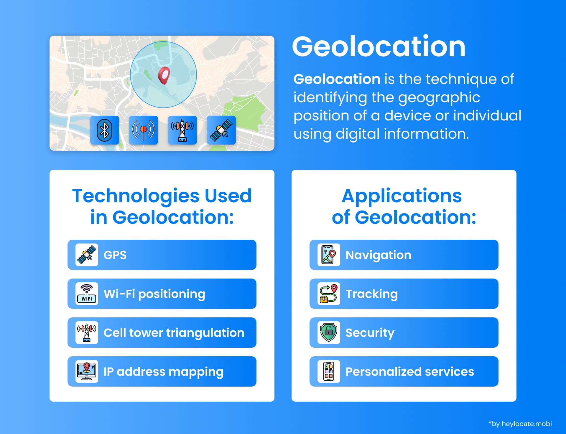
Geolocation is determining the exact geographic location of a person, device, or object. It utilizes different positioning technologies and techniques to ensure that the coordinates obtained are precise.
Geopositioning, on the other hand, is the process of finding out the location of a person or object in relation to its current surroundings. Geolocation and Geopositioning are now some of the most important components in digital technology, with many applications like navigation, mobile tracking, and internet geolocation.
Principles and Methods of Geopositioning
To comprehend geopositioning, it is imperative to grasp fundamental concepts such as geographic coordinates, map data, bearings, and ranges.
- Geographic coordinates, represented by latitude and longitude, express specific Earth surface locations in degrees, minutes, and seconds.
- Map datum is a reference framework for defining coordinates on maps or GPS systems.
- Bearings, measured in degrees, indicate the angle between a reference point and the line connecting two points, while ranges denote the distance between them, typically in meters or kilometers.
- Converting geographic positions into meaningful locations, like street addresses, is a critical aspect facilitated by geocoding techniques. Geocoding matches geographic coordinates with specific addresses, extensively utilized in navigation systems and location-based services.
Visual and Electronic Approaches
Geopositioning employs diverse visual and electronic methods.
- Visual techniques encompass position lines, circles, celestial navigation, and radio navigation. Position lines and circles aid in determining an object or person’s location, while celestial navigation relies on celestial bodies such as the sun and stars. Radio navigation utilizes signals to provide location information.
- Electronic methods, particularly satellite navigation systems like GPS, have transformed geopositioning. These systems utilize a network of satellites to deliver precise positioning information by triangulating signals from multiple satellites and calculating the user’s Earth position.
Position Fixing Techniques
Position fixing involves obtaining precise location fixes through geopositioning methods.
- Reference points are crucial for this process, offering known locations for measuring distances and angles. Distance measurements, like radar or sonar, determine proximity to objects or landmarks, while angle measurements, like compasses or sextants, indicate direction in relation to these reference points.
- Error minimization in position fixing is achievable through techniques such as utilizing multiple reference points, averaging measurements, and considering known error sources.
Computational Aspects
Computational methods are integral to geopositioning, particularly in satellite navigation systems like GPS.
- Position fixing entails solving linear equations to determine the user’s position in three-dimensional space. Regression algorithms and the least squares method are commonly utilized for accurate position computation.
- Integration of distance measurements with GPS satellites is crucial. GPS devices calculate distances between the user and each satellite by measuring signal travel time. Combining these measurements with satellite positions allows for accurate determination of the user’s Earth position.
Navigational Position Fixing Methods
| Method | Description | Advantages | Limitations |
|---|---|---|---|
| Manual or Visual | Involves using sighting devices like binoculars or sextants to determine bearings to known landmarks. Bearings are then plotted on charts for position determination | Highly accurate with precise equipment and reliable reference points | Limitations include the concept of the “cocked hat,” representing uncertainty in position fix obtained from three intersecting bearings |
| Electronic (e.g., GPS) | Utilizes satellite signals to provide accurate positioning information | Highly accurate and reliable, unaffected by weather or visibility conditions | Requires clear line of sight to multiple satellites, which may not always be available |
Position fixes are essential in dead reckoning navigation, estimating one’s current position based on a known position and movement speed/direction. Integrating position fixes into dead reckoning aids in updating estimated positions for more accurate movement tracking.
Practical Applications
Geopositioning finds application across various domains:
- User Location Tools in Apps: Applications like WhatsApp utilize geopositioning to facilitate location sharing among users, enabling meet-ups and real-time updates.
- Food Delivery Services: Companies like UberEATS and DoorDash employ geopositioning for efficient driver routing and optimized delivery routes.
- Military Applications: Geopositioning technologies are vital for coordinating forces and responding to military threats.
- Agricultural Sector: Geopositioning aids in forecasting and managing crop pathogens, optimizing fungicide use, and minimizing disease impact.
References
- B. Hofmann-Wellenhof; K. Legat; M. Wieser (28 June 2011). Navigation: Principles of Positioning and Guidance. Springer Science & Business Media
- Gentile, C.; Alsindi, N.; Raulefs, R.; Teolis, C. (2012). Geolocation Techniques: Principles and Applications. Springer New York.
- Laurie Tetley; David Calcutt (7 optimize. Electronic Navigation Systems. Routledge.
- Geopositioning – Wikipedia
- Geolocation: What it is, How it Works, Examples
- What is Geolocation: How It Works and Its Many Uses – Geoapify
- What is geolocation?