Geotagging
What is Geotagging?
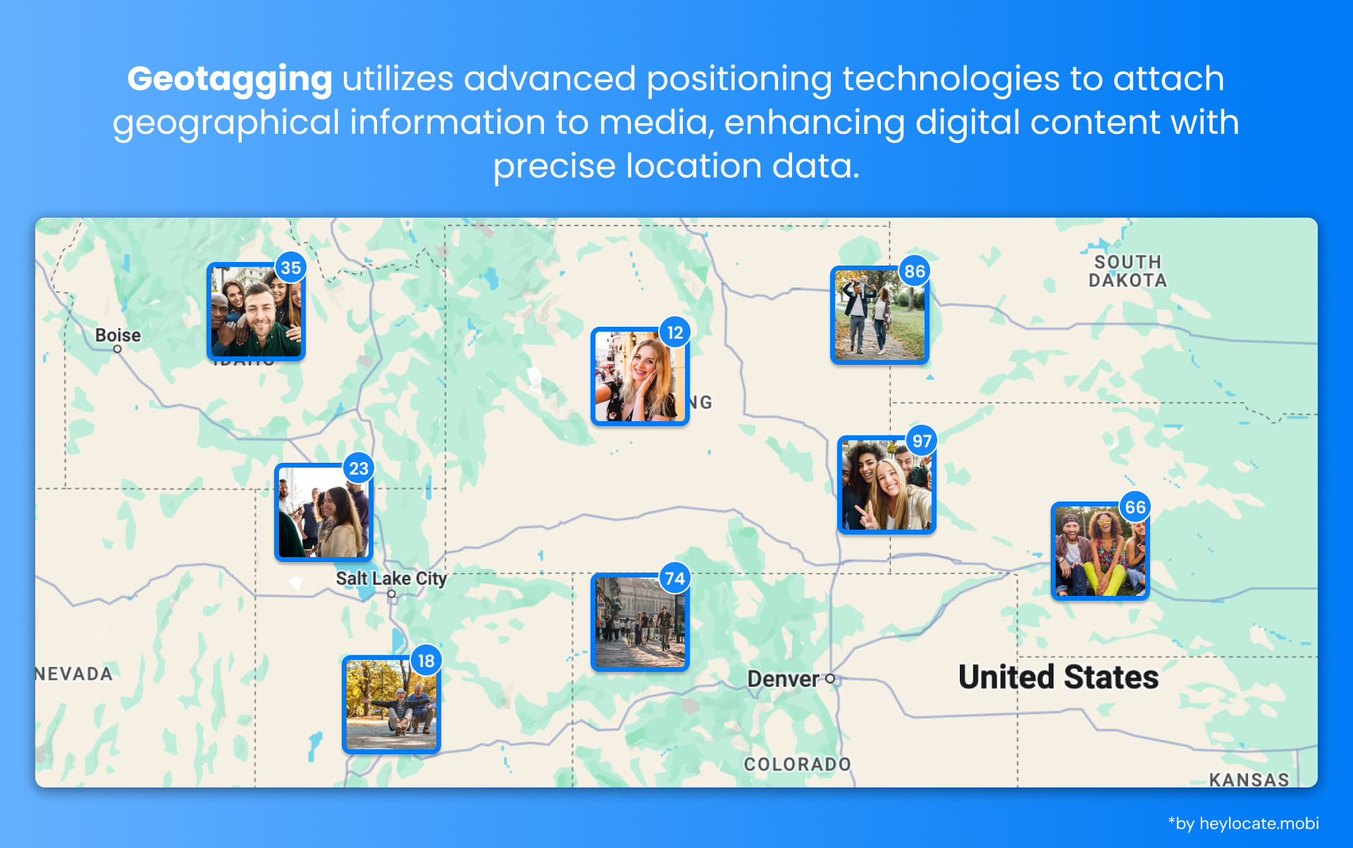
Geotagging is the inclusion of geographical identification metadata in different types of media files, such as photographs, videos, audio recordings, and social media posts. This embedded metadata typically includes latitude and longitude coordinates, enabling users to precisely determine the location where the media was captured or created.
Components of Geotagging
The components of geotagging encompass various elements that furnish comprehensive details about the location where the media originated. These primary components include:
- Latitude and Longitude: These coordinates pinpoint a specific location on the Earth’s surface. Latitude denotes the distance north or south of the equator, while longitude denotes the distance east or west of the prime meridian.
- Altitude refers to the height above or below sea level at which the media was captured.
- Time Stamps: These indicate the precise date and time when the media was created or captured, facilitating the chronological organization and sorting of media files.
Applications and Uses of Geotagging
Geotagging boasts diverse applications across numerous domains, including social media, photography, remote sensing, audio/video recording, and web content. Below is an overview of these applications:
| Application/Use Case | Description |
|---|---|
| Social Media | Share location with posts, allowing friends and followers to see where you are. Discover nearby places and target local customers for businesses |
| Photography | Record the exact location of a photo. It helps remember shooting locations, sharing work, or creating location-based portfolios |
| Remote Sensing and Georeferencing | Precisely locate and analyze specific areas of interest in satellite imagery, aerial photography, and LiDAR scanning |
| Audio/Video Geotagging | Add context to recordings by indicating where they were made. Useful in journalism, documentary filmmaking, or personal video diaries |
| Messaging and Web Content | Share location with others in SMS messages and provide spatial information for websites or online resources |
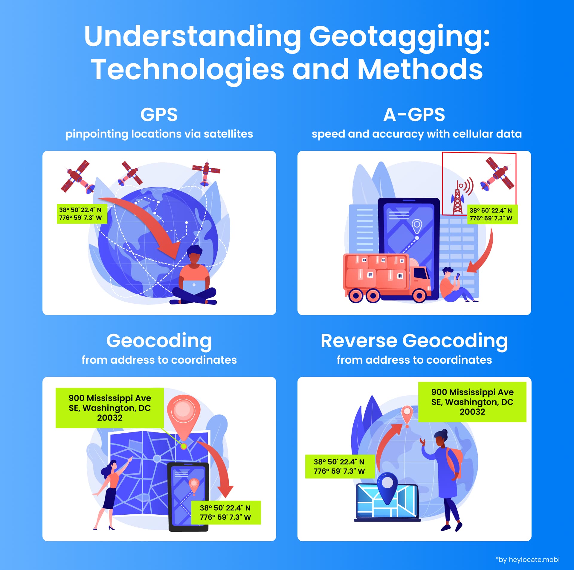
Technology and Methods
Geotagging relies on various technologies and methods for capturing and storing location information:
- GPS (Global Positioning System): The satellite navigation system that precisely indicates specific locations. GPS-enabled devices get signals from the satellite for geotagging media files that the geographical coordinates can identify.
- A-GPS (Assisted GPS): Improved GPS version that leverages network data of mobile services to speed up the process of getting a GPS fix, especially in those areas with difficult or low visibility to satellites.
- Geocoding: Transforms a textual location or place name address into the geographic coordinates (latitude and longitude) for geotagging.
- Reverse Geocoding: This function transforms reverse geo-codes back to a readable address or location that is then displayed as a name instead of coordinates.
Privacy and Security Concerns
The phenomenon of geotagging comes with many advantages but poses major security and privacy issues. Openly sharing your location could bring unexpected effects and dangers to you. Here are some potential risks of geotagging.
- Privacy Invasion: Sending out the location data could expose private details like home address, workplace, or routines. Stalkers or burglars could exploit it.
- Location Tracking: Geotagging can easily allow for location tracking, carried out without consent, and used in surveillance and monitoring activities.
- Public Disclosure: Clumsily revealing sensitive locations by geotagging media files or social media posts, like a child’s school.
- Identity Theft: With the help of geotagged data and personal information, criminals can create in-depth profiles to steal identity.
References
- Geotagging – Wikipedia
- What is geotagging and why it is important? – Precisely
- How Does Geotagging Work? – GIS Geography
- Geotagging Definition
- What is Geotagging? – Definition from Techopedia